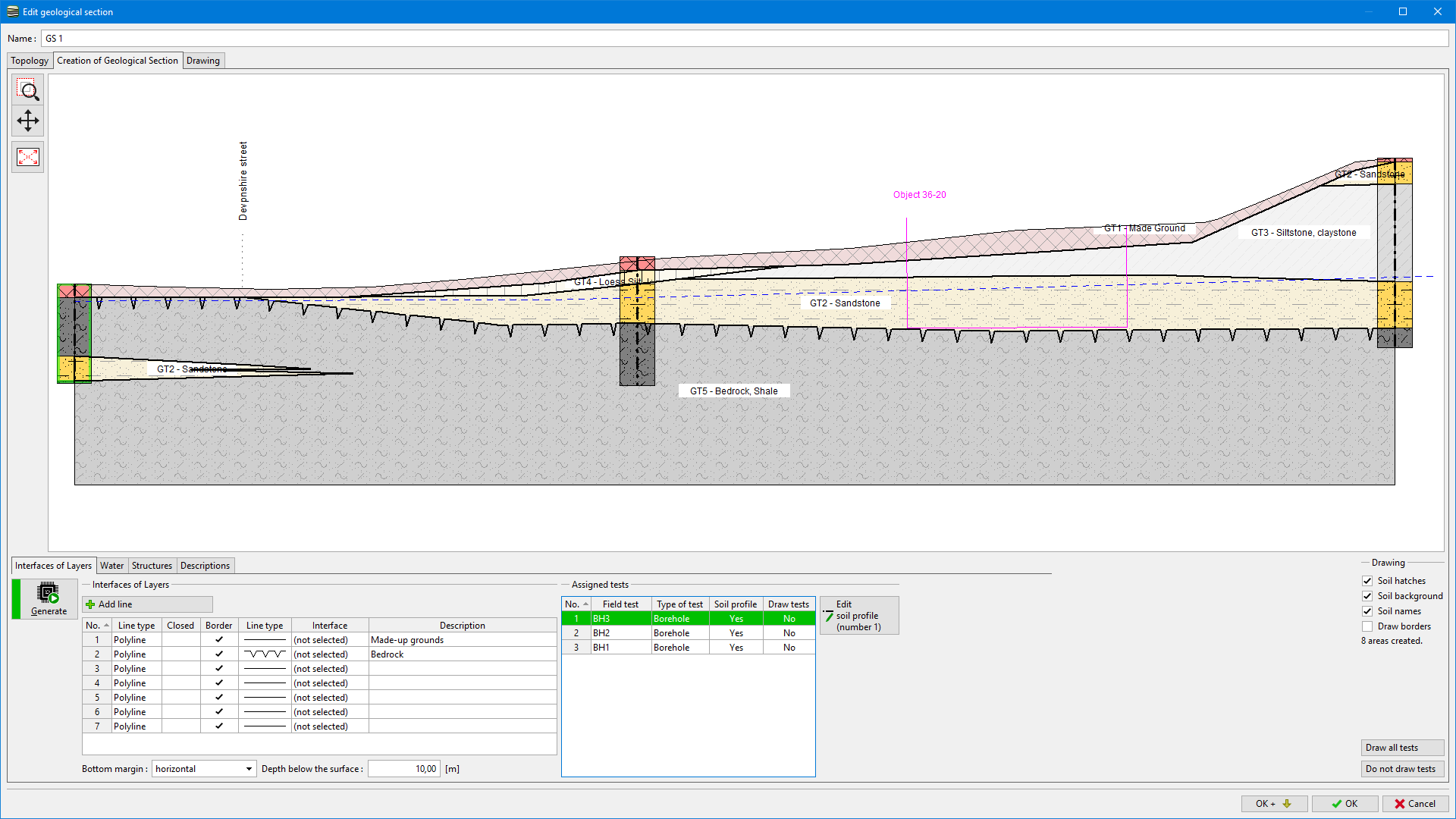
Creation of Geological Section
In this tab, the geological section is created.
In the subtabs, we define:
- Interface of layers of soils, geotechnical soil types
- Levels of groundwater table
- Structures, auxiliary lines
- Descriptions in the drawing
In this dialog window, it is possible to define lines of interfaces and this way create a geological section, and also edit soil profiles, and create points of interfaces for 3D model generation.
The geological section can also be created from the already generated geological model.
 "the creation of a geological Section" Tab
On the left side of the dialog window, there is a "Generate" button serving for area generation. The program automatically detects areas created by input lines and soil profiles. All lines marked as "Creating border of area" are used for areas generation. If more then one soil interferes with one area, the area is unclear, and a soil is not assigned.
On the right side of the dialog window, the drawing of the created geological section is defined. The possibility of field tests drawing is very important - the buttons "Draw all tests" and "Do not draw tests" is used when soil profiles are edited.
In the bottom part of the dialog window, the bottom margin of the model is defined. It can be horizontal, parallel to terrain (it is necessary to define depth below the terrain), or arbitrary continuous interface can be used.